Tuesday, September 26, 2017

MOUNT BOMBALAI

MOUNT BOMBALAI


Mount Bombalai is part of a volcanic field on the Semporna peninsula in northeastern Borneo. THe volcano lies in Tawau Division, Sabah, Malaysia across Cowie Harbour from the Indonesian province of East Kalimantan, and is the only volcano in the country. The low volcanic cone is located north of Sebatik Island and has a roughly 300-m-wide crater breached to the south. Two young lava flows extend almost to the coastal plain. The flows were considered younger than a lava flow radiocarbon dated at about 27,000 years before present, and the extrusion of basaltic lavas possibly continued into Holocenetime. this marks is the only known area of possible Holocene volcanism on Borneo. It is also known to be Malaysia's highest volcanic point.

Wednesday, April 19, 2017

MT. KINABALU PACKAGE COST FOR YEAR 2017

2D1N MOUNT KINABALU CLIMB (BUDGET) - MALAYSIAN ONLY 

2017 Climb Package Rates:

GROUP SIZE MALAYSIAN
1 PAX MYR 1,450
2 - 3 PAX MYR 1,185
4 - 6 PAX MYR 1,080
7 - 15 PAX MYR 995
16 - 28 PAX MYR 960
29 PAX AND ABOVE For big group discounts, please email info@mountkinabalu.com directly.
Note:
  • All rates are quoted in Ringgit Malaysia (MYR) and are inclusive of 6% Goods & Service Tax (GST).
  • Climbers below 16 years old are considered Child and will be accompanied by a separate mountain guide.
  • Please contact us directly at info@mountkinabalu.com to enjoy further discount for groups of 29 pax and above.

2D1N MOUNT KINABALU CLIMB

2017 Climb Package Rates:

GROUP SIZE MALAYSIAN INTERNATIONAL
1 PAX MYR 1,750 MYR 2,130
2 - 3 PAX MYR 1,500 MYR 1,880
4 - 6 PAX MYR 1,400 MYR 1,780
7 - 15 PAX MYR 1,320 MYR 1,700
16 - 30 PAX MYR 1,270 MYR 1,650
31 PAX AND ABOVE For big group discounts, please email info@mountkinabalu.com directly.
Note:
  • All rates are quoted in Ringgit Malaysia (MYR) and are inclusive of 6% Goods & Service Tax (GST).
  • Climbers below 16 years old are considered Child and will be accompanied by a separate mountain guide.
  • Please contact us directly at info@mountkinabalu.com to enjoy further discount for groups of 31 pax and above.

For those who are planning to climb Mt. Kinabalu, you can refer these packages. If you want more information, you can refer to http://www.mountkinabalu.com/packages

Tuesday, April 18, 2017

Brief Information About Mount Kinabalu


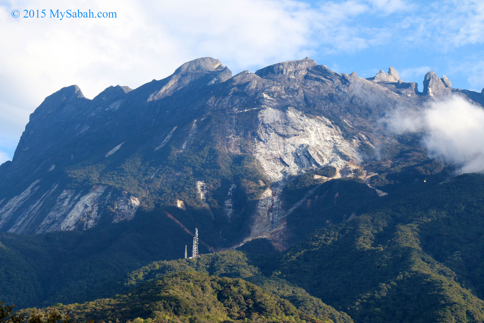
Mount Kinabalu is a mountain in Sabah, Malaysia. It is protected as Kinabalu Park, a World Heritage Site. Kinabalu is the highest peak in Borneo's Crocker Range and is the highest mountain in the Malay Archipelago as well as the highest mountain in Malaysia. Mount Kinabalu is also the 20th most prominent mountain in the world by topographic prominence.
In 1997, a re-survey using satellite technology established its summit (known as Low's Peak) height at 4,095 metres (13,435 ft) above sea level, which is some 6 metres (20 ft) less than the previously thought and hitherto published figure of 4,101 metres (13,455 ft).
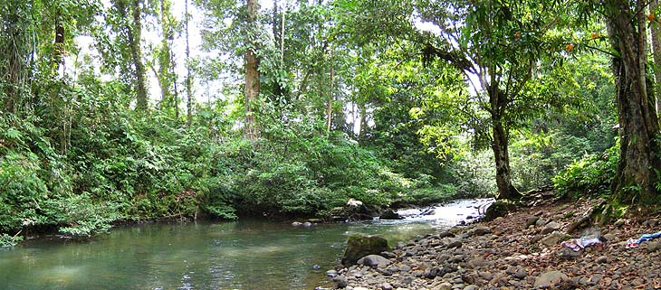
Mount Kinabalu includes the Kinabalu montane alpine meadows ecoregion in the montane grasslands and shrublands biome. The mountain and its surroundings are among the most important biological sites in the world, with between 5,000 and 6,000 species of plants, 326 species of birds, and more than 100 mammalian species identified. Among this rich collection of wildlife are famous species such as the gigantic Rafflesia plants and orangutans. Mount Kinabalu has been accorded UNESCO World Heritage status.
Low's Peak can be climbed quite easily by a person in good physical condition and there is no need for mountaineering equipment at any point on the main route. Other peaks along the massif, however, require rock climbing skills.


Biology

Mount Kinabalu along with other upland areas of the Crocker Range is known worldwide for its botanical and biological species diversity with plants of Himalayan, Australasian, and Indomalayan origin. A recent botanical survey of the mountain estimated a staggering 5,000 to 6,000 plant species (excluding mosses and liverworts but including ferns), which is more than all of Europe and North America (excluding tropical regions of Mexico) combined. It is therefore one of the world's most important biological sites.
In 2015, a major Malaysian-Dutch study showed that the unique flora, fauna, and fungi on the mountain summit are younger than the mountain itself, and have evolved from both local and distant montane ancestors.

History

British colonial administrator Hugh Low made the first recorded ascent of Mount Kinabalu's summit plateau in March 1851. Low did not scale the mountain's highest peak, however, considering it "inaccessible to any but winged animals". In April and July 1858, Low was accompanied on two further ascents by Spenser St. John, the British Consul in Brunei. The highest point of Mount Kinabalu was finally reached in 1888 by zoologist John Whitehead.British botanist Lilian Gibbs became the first woman and the first botanist to summit Mount Kinabalu in February 1910.
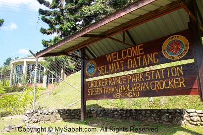
Botanist E.J.H Corner led two important expeditions of the Royal Society of Great Britain to the mountain in 1961 and 1964. Kinabalu National Park was established in 1964. The park was designated a natural World Heritage Site in 2000.


Source taken from:
https://en.wikipedia.org/wiki/Mount_Kinabalu
http://www.mysabah.com/wordpress/wp-content/uploads/2015/06/20120910_36.jpg

Tuesday, July 1, 2014

Tunku Abdul Rahman National Park


Tunku Abdul Rahman National Park comprises a group of 5 islands located between 3 to 8 km off Kota Kinabalu. The park is spread over 4,929 hectares, two thirds of which cover the sea. Before the Ice age, it formed part of the Crocker Range mass of sandstone and sedimentary rock on the mainland. However, about one million years ago, the melting ice brought about changes in the sea level and parts of the mainland were cut off by the sea to form the islands of Pulau Gaya, Pulau Sapi, Pulau Manukan, Pulau Mamutik dan Pulau Sulug. Evidence of this can be seen from the exposed sandstone of the coastline forming the cliffs, caves, honeycombs and deep crevices. The park was named after Tunku Abdul Rahman, Malaysia's first Prime Minister.
Jesselton Point Ferry Terminal in downtown Kota Kinabalu is the ferry terminal for those heading to the islands in Tunku Abdul Rahman National Park (Pulau Gaya, Pulau Sapi, Pulau Manukan, Pulau Mamutik dan Pulau Sulug). This ferry terminal is also the departure point for patrons staying at either Manukan Island Resort or Gayana Resort.


information source: http://en.wikipedia.org/wiki/Tunku_Abdul_Rahman_National_Park


Sunday, February 17, 2013

Crocker Range Park

Crocker Range Park was established in 1984, although the area had previously been under protection as a forest reserve. It covers the north-south Crocker Range, of 1200-1800 meter mountains in Sabah, east Malaysia on the island of Borneo, which separate the western coastal plain with the rest of the state. The boundaries of the park have been surveyed, but no facilities exist at present for visitors.
The park covers 1,399 km², making it the largest park in Sabah. The park consists of both hill and montane forest, with many species of flora and fauna endemic to Borneo. Maintenance of this forest cover is essential to ensuring a pure water supply for many of the towns and communities in Sabah.
The park contains at least five species of primates, such as the orang-utan, gibbons and the furry tarsier with its enormous round eyes, and extremely sociable long-tailed macaques. The Padas River bisects the range between Beaufort and Tenom.
Crocker Range Park is administered by Sabah Parks.

Reference
1. http://en.wikipedia.org/wiki/Crocker_Range_National_Park
2.http://www.mysabah.com/images/2011/20110825_5.jpg

Tabin Wildlife Reserve

Tabin Wildlife Refuge is a nature preserve in Sabah, eastern Malaysia, on the island of Borneo. It was created in 1984 to preserve Sabah’s disappearing wild animals. Occupying a large part of the peninsula forming the northern headland of Darvel Bay, it is located 48 kilometers east of Lahad Datu.
Tabin Wildlife Reserve (TWR or Tabin) comprises a rectangular area of approximately 122,539 ha. in the centre of the Dent Peninsula, north-east of Lahad Datu town, south of the lower reaches of the Segama River and north of the Silabukan Protection Forest Reserve. It can be reached via sealed and gravel roads from Lahad Datu in about 40 minutes. The reserve is covered with lowland dipterocarp forest.

Fauna

Tabin has been declared a Wildlife Reserve primarily on account of the large number of animals inhabiting its forests, some of which are highly endangered. The three largest mammals of Sabah – the Borneo Elephant, Sumatran Rhinoceros and Tembadau (Bos javanicus), are all found within the reserve. The elephant population has been estimated to 120-300 animals in 1993. Other ungulate species include Sambar, Muntjac and Mouse Deer. In addition seven of Sabah´s eight primate species are present, among them Orang Utan and Proboscis Monkey. However, these two species occur in relatively low numbers in the reserve. The biggest predator in the reserve is the Sunda Clouded Leopard. There are also several other smaller carnivores in the reseve.[1] Of bird species, 42 families representing 220 species have been recorded.


Organisation

The land belongs to the people of Sabah. It is under government ownership and has Reserve status. The Sabah Wildlife Department is the custodian of the animals in the reserve. The Sabah Forestry Department is responsible for the trees in Tabin. In 1998, the Malaysian government privatized ecotourism programmes for Tabin and over the last few years increasing numbers of tourists have been coming to the reserve. Among activities permitted in the reserve are jungle trekking, wildlife viewing, photography and filming. Natural mud volcanoes are an important natural attraction for wildlife seeking salt, and these have become a bonus for visitors coming to see wild animals.

Reference
1. http://en.wikipedia.org/wiki/Tabin_Wildlife_Reserve
2.https://blogger.googleusercontent.com/img/b/R29vZ2xl/AVvXsEjiBDSN9qMFaIRO31iehtzQ70NjXE_gJCJ7RYY3Ju9sIVuFF22YOhvntMNCk7Ye86-pEV8l1SSwneFvT6PKKB7ScCj_6gvy9SDe_Nt-X-AO6E8zUWf6YuX2MEmZSsEd-gny3PxxBdcOfJ29/s1600/waterfall.jpg

Tawau Hills National Park

Tawau Hills Park, was established in 1979, primarily as a protection for the water catchment area of Tawau town, in Sabah, east Malaysia on the island of Borneo. It is located 24 kilometers from Tawau, and comprises 279.72 km² of lowland dipterocarp rainforest, surrounded by oil palm and cacao plantations. The park offers picnic areas, camping sites, and chalets. The Park contains rugged volcanic landscapes including a hot spring and spectacular waterfalls. The highest point in the park is Gunung Magdalena (1310 m). It is administered by the Sabah Parks.